


Claudelle Naidoo, GroupM SSA CEO: From inclusion to involvement
Claudelle Naidoo
Subscribe & Follow
Advertise your job vacancies
Trending


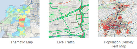
AfriGIS GISlike powers decision-making and business analytics for leading franchise and retail outlets
Know "Where?" your customers are and identify potential business areas for growth throughout your network.
With the powerful simplicity of AfriGIS GISlike information is visually displayed on a map making it easy to view sales patterns, analyse competitor activities and identify customer trends.
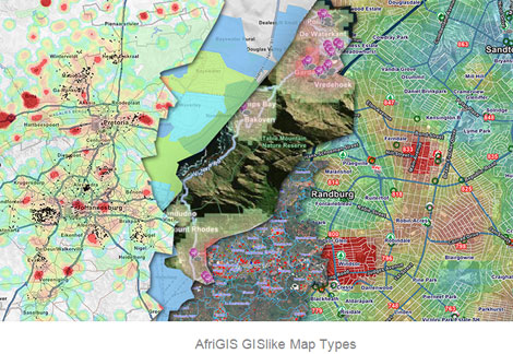
Through the use of AfriGIS GISlike potential franchise owners can do a lot of research before putting up shop, for example learning about the average income of the neighbourhood he plans to establish his business in, the traffic flowing past his shop, the number of other businesses in the area, and even the crime rate in the region.
AfriGIS GISlike is an
online mapping and analysis application
that enables you to
streamline your planning and operations by mapping your own data, together with extensive AfriGIS and Census datasets.
Therefore you can
view and analyse your customer data on a map and then adjust or modify your trade areas or maintenance and sales strategies in context of Census and other AfriGIS datasets.
Benefits
- Business analyses
- Market research and profiling
- Online demographic mapping
- Consumer profiling
- Risk profiling, analysis and management
- Trend analysis
- Municipal asset management
- Gap analysis to determine potential business areas
Try it now:
https://www.afrigis.co.za/solutions/products/evaluate/gislike/
We create ONE OF A KIND GEOSPATIAL SOLUTIONS. We use geospatial information science to bring information about WHERE to life across industries and in any application. This helps our clients unlock value through better business intelligence.
- How GIS is transforming municipal property management30 Jul 15:11
- Why spatial data accuracy matters26 Jun 13:43
- Staying ahead of unpredictable weather conditions20 Jun 14:00
- Beyond borders – AfriGIS develops verified geospatial data for Africa30 May 13:52
- AfriGIS’s Peter Smythe appointed to GeoServer Project Steering Committee14 May 13:23